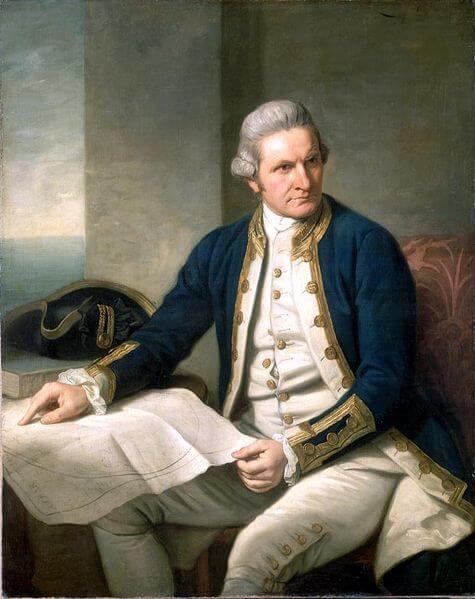
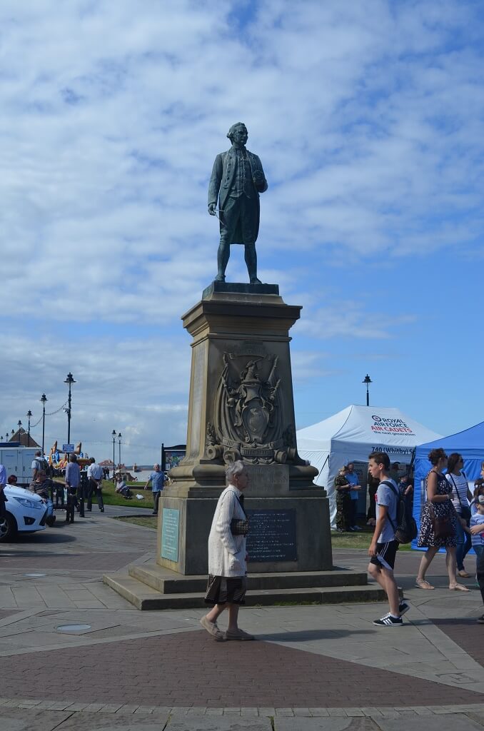
Captain James Cook’s Portrait
Captain James Cook
Captain James Cook, RN was an English explorer, navigator and cartographer.
He made three voyages to the Pacific Ocean, accurately charting many areas and recording several islands and coastlines on European maps for the first time.
His most notable accomplishments were the British discovery and claiming of the east coast of Australia; the European discovery of the Hawaiian Islands; and the first circumnavigation and mapping of Newfoundland and New Zealand.
Early Life
Cook was born in relatively humble circumstances in the village of Marton in Yorkshire, today a suburb belonging to the town of Middlesbrough.
He was baptised in the local church of St. Cuthbert’s where today his name can be seen in the church register. Cook was one of five children of James Cook, a Scottish farm labourer, and his locally born wife Grace Pace. In 1736, his family moved to Airey Holme farm at Great Ayton, where his father’s employer, Thomas Skottowe paid for him to attend the local school.
In 1741, after 5 years schooling, he began work for his father, who had by now been promoted to farm manager. When he had time off from the farm, he’d take himself off up nearby Roseberry Topping, climbing which gave him his first taste for adventure and exploration which was to stay with him for life.
In 1745, when he was 16, Cook moved 20 miles to the fishing village of Staithes to be apprenticed in a grocery/haberdashery business, where he first felt the lure of the sea while gazing out of the shop window.
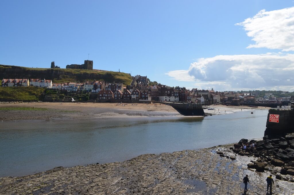
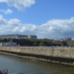
Mud banks on the Esk at Whitby
Merchant Navy
After 18 months, not proving suitable for shop work, his boss William Sanderson took Cook to the nearby port town of Whitby and introduced him to John and Henry Walker. The Walkers were prominent local ship-owners and Quakers, and were in the coal trade. Their house is now the Captain Cook Memorial Museum. Cook was taken on as a merchant navy apprentice in their small fleet of vessels plying coal along the English coast.
His first assignment was aboard the collier Freelove, and he spent several years on this and various other coasters sailing between the Tyne and London. His three-year apprenticeship completed, Cook began working on trading ships in the Baltic Sea. He soon progressed through the merchant navy ranks, starting with his 1752 promotion to Mate (officer in charge of navigation) aboard the collier brig Friendship.
In 1755, within a month of being offered command of this vessel, he volunteered for service in the Royal Navy, as Britain was re-arming for what was to become the Seven Years’ War. Despite the need to start back at the bottom of the naval hierarchy, Cook realised his career would advance more quickly in military service.
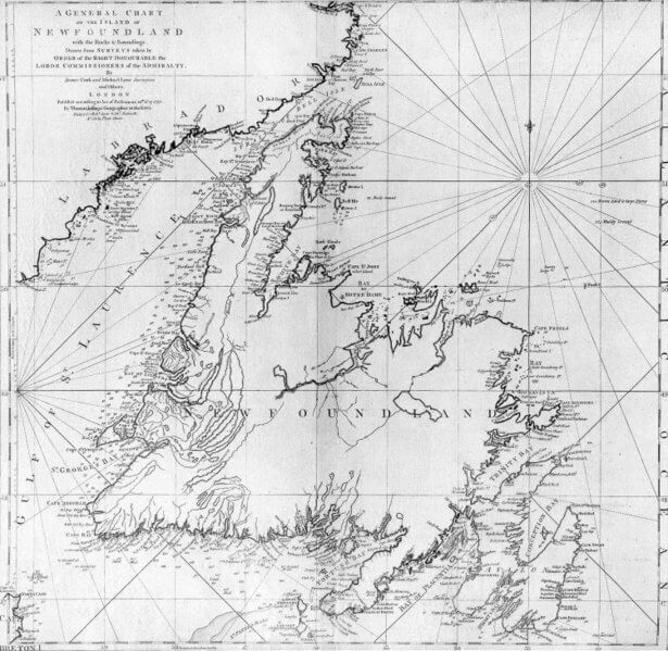
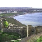
Captain Cooks Newfoundland
Royal Navy
On 7 June 1755 Cook volunteered to join the Royal Navy at Wapping, sensing an imminent war was approaching. His first posting was with HMS Eagle under Hugh Palliser, sailing with the ship in March of 1756 with the rank of boatswain.
Within two years of joining the Royal Navy Cook passed his master’s examinations at Trinity House, Deptford qualifying him to navigate and handle a ship of the King’s fleet. He then joined the frigate HMS Solebay as master under Captain Robert Craig.
He showed a talent for surveying and cartography and was responsible for mapping much of the entrance to the Saint Lawrence River during the siege, allowing General Wolfe to make his famous stealth attack on the Plains of Abraham.
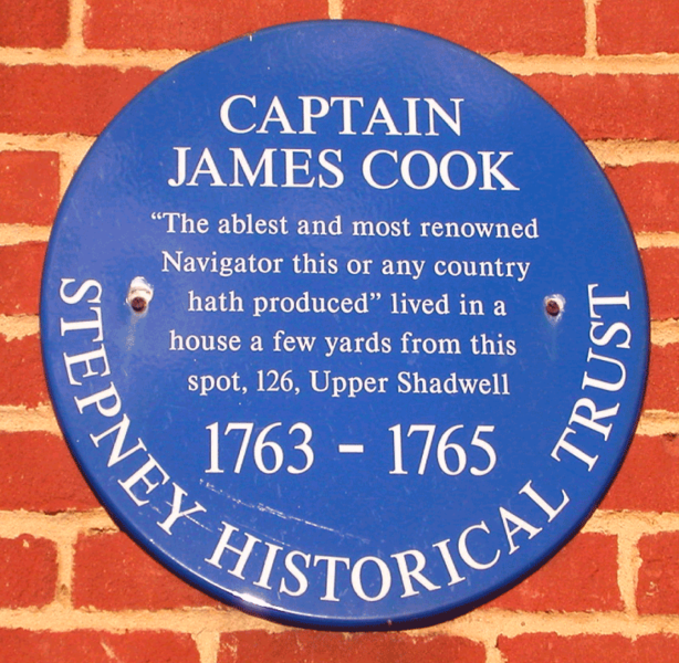
Cook’s surveying skills were put to good use in the 1760s, mapping the jagged coast of Newfoundland. Cook surveyed the northwest stretch in 1763 and 1764, the south coast between the Burin Peninsula and Cape Ray in 1765 and 1766, and the west coast in 1767.
Cook’s five seasons in Newfoundland produced the first large-scale and accurate maps of the island’s coasts; they also gave Cook his mastery of practical surveying and brought him to the attention of the Admiralty and Royal Society.
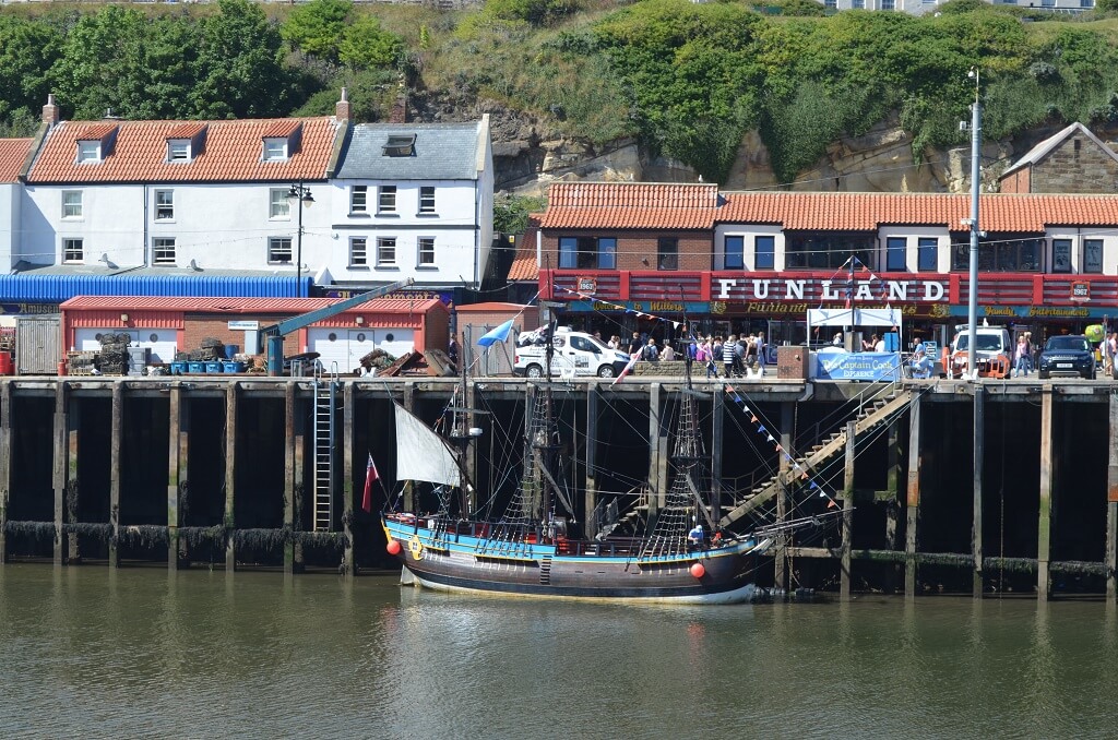
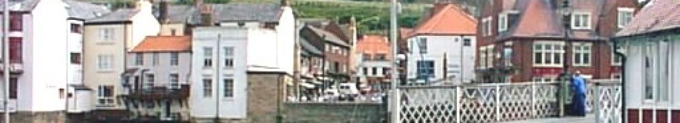
Endeavour moored at Whitby
HMS Endeavour
In 1766, the Royal Society hired Cook to travel to the Pacific Ocean to observe and record the transit of Venus across the Sun. He sailed in the HMS Endeavour from England in 1768, rounded Cape Horn and continued westward across the Pacific to arrive at Tahiti on 13 April 1769, where the observations were to be made.
Cook later mapped the complete New Zealand coastline, making only some minor errors.
He then sailed west, reaching the south-eastern coast of the Australian continent on 19 April 1770, and in doing so his expedition became the first recorded Europeans to have encountered its eastern coastline.
On 23 April he made his first recorded direct observation of indigenous Australians at Brush Island near Bawley Point.
On 29 April Cook and crew made their first landfall on the mainland of the continent at a place now known as the Kurnell Peninsula, which he named Botany Bay after the unique specimens retrieved by the botanists Joseph Banks and Daniel Solander.
After his departure from Botany Bay he continued northwards, and a mishap occurred when Endeavour ran aground on a shoal of the Great Barrier Reef, on 11 June. The ship was badly damaged and his voyage was delayed almost seven weeks while repairs were carried out on the beach at the mouth of the Endeavour River.
Once repairs were complete the voyage continued, sailing through Torres Strait and on 22 August he landed on Possession Island, where he claimed the entire coastline he had just explored as British territory.
He returned to England via the Cape of Good Hope and Saint Helena, arriving on 12 July 1771.
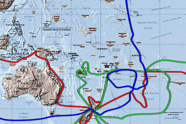
Captain James Cooks Sea Routes
HMS Resolution
In 1766, the Royal Society hired Cook to travel to the Pacific Ocean to observe and record the transit of Venus across the Sun. He sailed in the HMS Endeavour from England in 1768, rounded Cape Horn and continued westward across the Pacific to arrive at Tahiti on 13 April 1769, where the observations were to be made.
Cook later mapped the complete New Zealand coastline, making only some minor errors.
He then sailed west, reaching the south-eastern coast of the Australian continent on 19 April 1770, and in doing so his expedition became the first recorded Europeans to have encountered its eastern coastline.
On 23 April he made his first recorded direct observation of indigenous Australians at Brush Island near Bawley Point.
On 29 April Cook and crew made their first landfall on the mainland of the continent at a place now known as the Kurnell Peninsula, which he named Botany Bay after the unique specimens retrieved by the botanists Joseph Banks and Daniel Solander.
After his departure from Botany Bay he continued northwards, and a mishap occurred when Endeavour ran aground on a shoal of the Great Barrier Reef, on 11 June. The ship was badly damaged and his voyage was delayed almost seven weeks while repairs were carried out on the beach at the mouth of the Endeavour River.
Once repairs were complete the voyage continued, sailing through Torres Strait and on 22 August he landed on Possession Island, where he claimed the entire coastline he had just explored as British territory.
He returned to England via the Cape of Good Hope and Saint Helena, arriving on 12 July 1771.
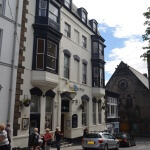
Captain Cook Whitby
Third Voyage
On his last voyage, Cook once again commanded HMS Resolution, while Captain Charles Clerke commanded HMS Discovery.
Ostensibly the voyage was planned to return Omai to Tahiti; this is what the general public believed, as he had become a favourite curiosity in London. Principally the purpose of the voyage was an attempt to discover the famed Northwest Passage.
After returning Omai, Cook travelled north and in returning from forays on the Alaskan coast (see below) in 1778 became the first European to visit the Hawaiian Islands. In passing and after initial landfall in January 1778 at Waimea harbour, Kauai, Cook named the archipelago the “Sandwich Islands” after the fourth Earl of Sandwich, the acting First Lord of the Admiralty.
From the South Pacific he travelled northeast to explore the west coast of North America, landing near the First Nations village at Yuquot in Nootka Sound on Vancouver Island, although he unknowingly sailed past the Strait of Juan de Fuca.
He explored and mapped the coast from California all the way to the Bering Strait, on the way identifying what came to be known as Cook Inlet in Alaska. It has been said that, in a single visit, Cook charted the majority of the North American northwest coastline on world maps for the first time, determined the extent of Alaska and closed the gaps in Russian (from the West) and Spanish (from the South) exploratory probes of the Northern limits of the Pacific.
The Bering Strait proved to be impassable, although he made several attempts to sail through it. He became increasingly frustrated on this voyage, and perhaps began to suffer from a stomach ailment; it has been speculated that this led to irrational behaviour towards his crew, such as forcing them to eat walrus meat, which they found inedible.
Cook returned to Hawai`i in 1779. After sailing around the archipelago for some eight weeks, he made landfall at Kealakekua Bay, on ‘Hawai`i Island’, largest island in the Hawaiian Archipelago.
Captain James Cook Plaque
Death of James Cook
After a month’s stay, Cook got under sail again to resume his exploration of the Northern Pacific. However, shortly after leaving Hawai`i Island, the foremast of the Resolution broke and the ships returned to Kealakekua Bay for repairs.
On 14 February at Kealakekua Bay, some Hawaiians took one of Cook’s small boats. Normally, as thefts were quite common in Tahiti and the other islands, Cook would have taken hostages until the stolen articles were returned. Indeed, he attempted to take hostage the King of Hawai`i, Kalaniopu`u. The Hawaiians prevented this, and Cook’s men had to retreat to the beach.
As Cook turned his back to help launch the boats, he was struck on the head by the villagers and then stabbed to death as he fell on his face in the surf. The Hawaiians dragged his body away.
The esteem in which he was nevertheless held by the Hawaiians resulted in his body being retained by their chiefs and elders.
Following the practice of the time, Cook’s body underwent funerary rituals similar to those reserved for the chiefs and highest elders of the society. The body was disemboweled, baked to facilitate removal of the flesh, and the bones were carefully cleaned for preservation as religious icons in a fashion somewhat reminiscent of the treatment of European saints in the Middle Ages.
Some of Cook’s remains, disclosing some corroborating evidence to this effect, were eventually returned to the British for a formal burial at sea following an appeal by the crew.